Over the next couple of weeks, I’m going to be rolling out a whole lot of information about pipelines. Why?
Because these metal tubes are truly the blood vessels of the oil and gas industry. Without them, the industry wouldn’t be able to deliver the liquid fossil fuels to their refineries, or out to the customers after that. Technically, it could be done with trucks and trains and tankers, but the economics just wouldn’t work. Without pipelines, liquid fossil fuels become impractically expensive.
(Note: you can find all of the posts in the pipeline series with the “pipeline” tag, or by following the links at the bottom of my post.)
So through one lens, pipelines are incredible. They cart valuable petroleum products from source to refinery to end use with remarkable efficiency. And they do so really cheap!
But not all is so rosy with these tools of fossil energy infrastructure. Pipelines leak and spill – pretty often, actually. They run through fragile ecosystems, under waterways, and across incredibly valuable aquifers. And as crucial as they are in delivering affordable fuel to your gas tank or furnace, they’re pretty tempting targets for anyone who wants to deal our nation’s energy supply a serious blow. In other words, our dependance on oil and gas pipelines makes our nation vulnerable to a terrorist attack, a concern that’s been long established in security circles.
Pipelines are typically built and paid for by private companies. But public support is crucial to the industry, and it comes in many forms, from eminent domain takings to subsidies and tax breaks to favorable environmental impact reviews.
You typically don’t hear much about pipelines, unless something goes wrong. And even then, hearing something about them is rare.
So let’s start at the top, and explain the very nature of pipelines: what kinds there are, what functions they serve, and where they run.
Types of pipelines
In general, there are two main types of energy pipelines: oil pipelines and natural gas pipelines. For now, I’m going to focus on those that carry oil.
For the oil industry category, there are pipelines that carry crude and others that carry refined petroleum products. If you’ll allow me to expand the blood vessel metaphor, crude pipelines are technically the veins that carry crude oil from the source to refineries. Just like our veins, they get thicker as they get closer to the spot they dump their contents out. “Gathering lines,” typically about 8 to 24 inches in diameter, collect oil from wells and then hook up into larger “trunk lines” that carry the crude over long distances to the refineries. The famous Trans-Alaska Pipeline System (TAPS), a trunk line, is probably the most well-known American pipeline, and it’s a full 48 inches in diameter.
In all, there are roughly 55,000 miles of these thick crude oil trunk lines in the United States.
Refined product lines carry the end products of the oil industry – gasoline, jet fuel, home heating oil, diesel fuel, and so on. These stretch across nearly every American state (with a couple of exceptions in crowded New England), and in all, there are thought to be about 95,000 miles of refined product pipelines.
Where are they?
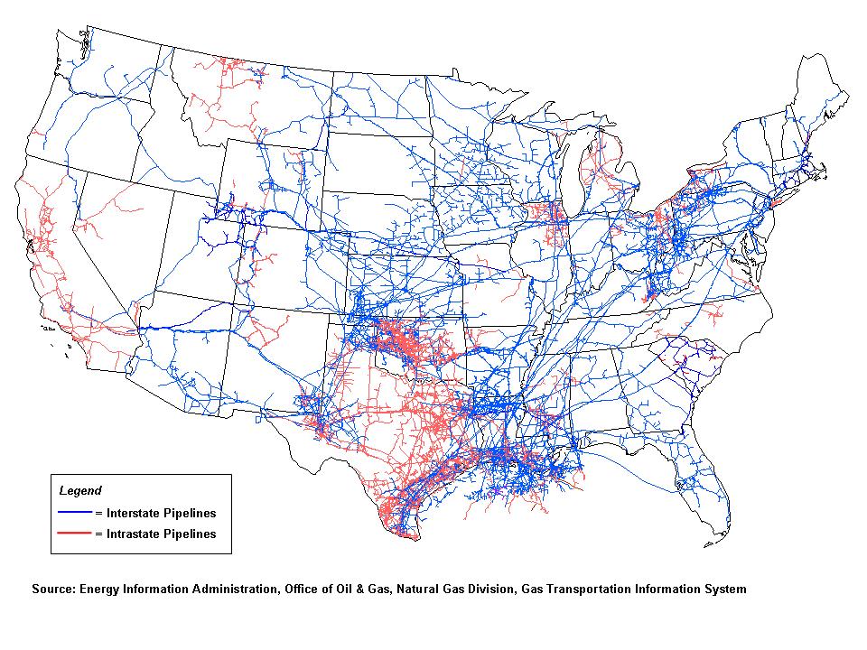
The first question that probably jumps to mind is: are there any near me? For crude oil, it’s actually not so easy to find out. Official natural gas pipeline maps are out there, like this one from the Energy Information Agency.
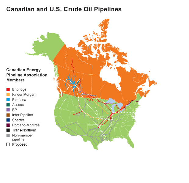
But for security reasons, official government websites don’t publish the locations of crude lines. On private company’s sites you can find some not-so-detailed maps. Like this one from Canada’s Centre for Energy.
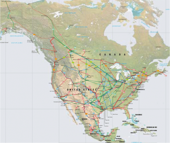
But by far the most comprehensive map I was able to find came from an interesting site called Theodora, an information publishing site that gathered lots of data from primary sources and mashed it up into this impressive map. Green lines are oil pipelines, red carry natural gas, and blue carry refined petroleum products.
Here is the larger map of North America:

And here is a closer look at the U.S. pipeline system:
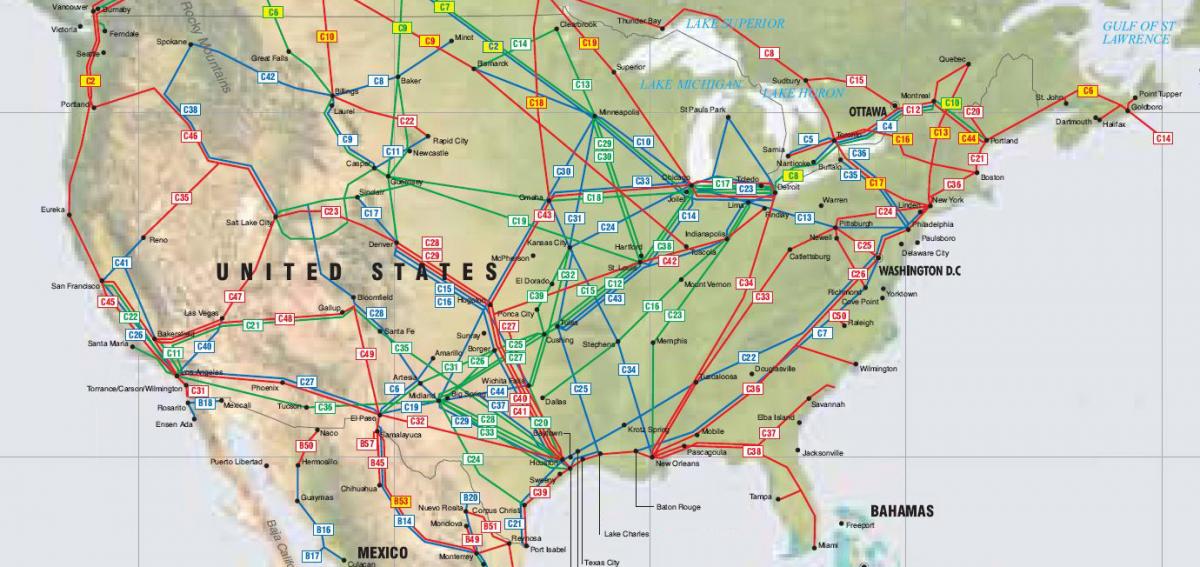
You can see how a bunch of big red “trunk lines” come down from Canada and Alaska, funneling crude to refineries in California and the coasts of Texas and Louisiana.
Check back soon for more information on pipelines. On Friday, we’ll have a special and urgent (considering a current piece of legislation in the House) post on pipelines that carry crude from Canadian tar sands. This diluted bitumen or “DilBit” is actually a potentially unstable blend of thick raw bitumen and volatile natural gas liquid condensates. It is highly corrosive, more acidic than “regular” crude, and as such, the likelihood of it spilling or leaking out of “DilBit” tar sands pipelines is far higher than normal. More on that Friday.
Read more in the pipeline series: